Volcan De Fuego - The Journey up Acatanengo
AIRVŪZ STAFF NOTE :
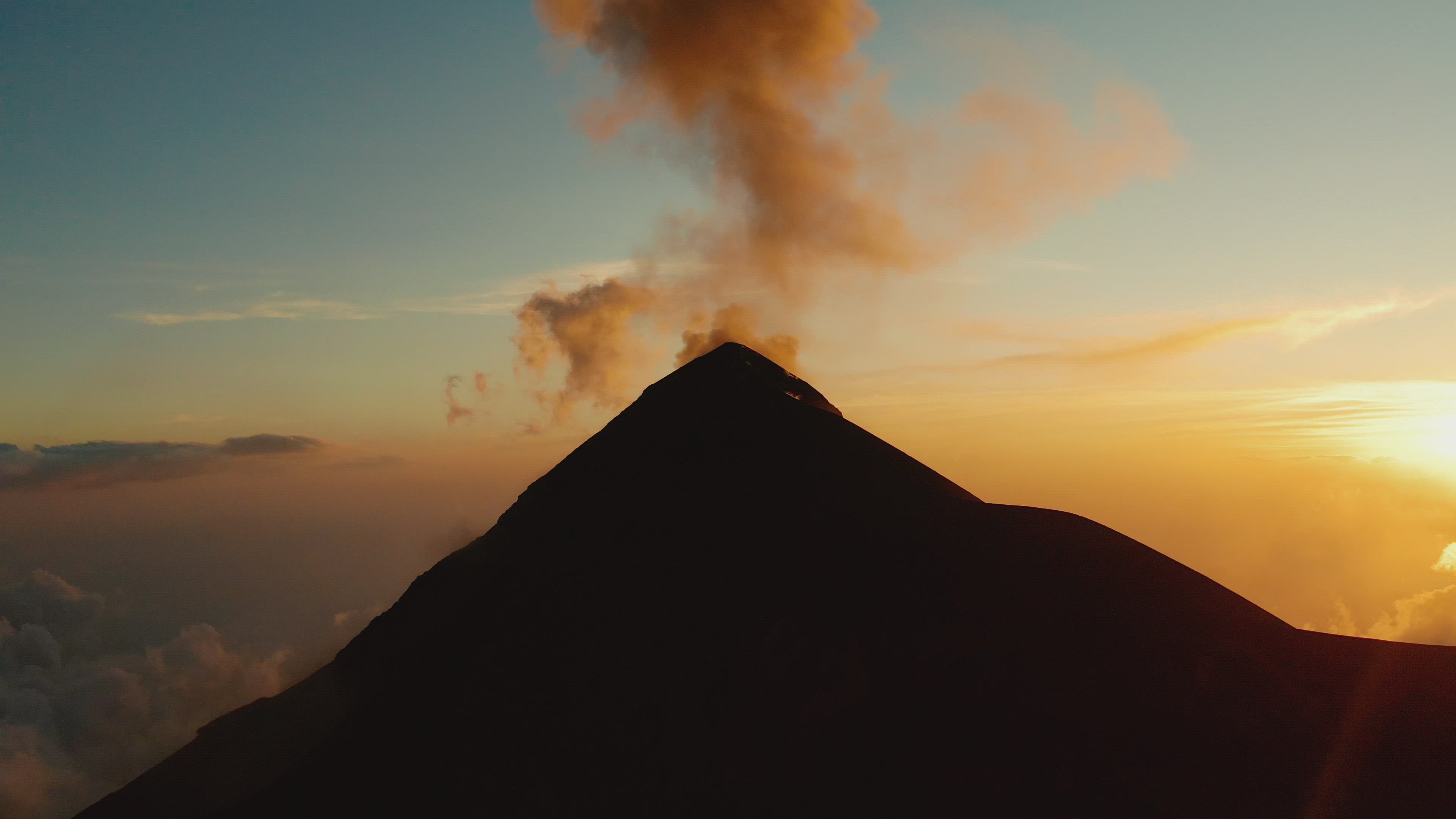
Check out this drone video of a famous Central American volcano, compliments of top contributor semberadventure. Guatemala's Volcán de Fuego is located about 16 km (around 10 mi.) west of the city of Antigua. The mountain is in a near-constant state of low-level activity, and is considered to be at risk for catastrophic eruption given the large population of the area. The video was shot from the perspective of the adjacent Acatanengo volcano, which has a peak elevation of almost 4k meters above sea level (just over 13k ft.).
- about 4 years ago
- 1.7k VŪZ
15 


- 25
- Report

BADGES THIS VIDEO HAS EARNED:

Volcan de Fuego, or volcano of fire, is the most active volcano in Guatemala and one of the most active in the world. In June of 2018 the volcano erupted and and killed hundreds of people in what was the deadliest eruption since 1929. To see this volcano up close, I hired a guide, and a small group hiked up the neighboring Acatanengo volcano. We camped overnight on volcano Acatanengo and watched Fuego erupt about every 20 min. When we arrived at the base camp before sunset, the clouds were covering Fuego, but you could still hear the eruptions. Shortly before sunset the clouds subsided, and we were blessed with perfect views to watch the eruptions all night. In the morning, we woke up early and hiked another hour and a half to the summit of Acatanengo at an altitude of 13,500 feet to watch the sunrise and see Fuego erupt. At the summit, you can see 13 of guatemala's 37 total volcanoes and the pacific ocean. This overnight guided trip was one of the best experiences I ever had, and I was very excited to capture the experience with the drone.
Up Next
Guatemala - Land of Volcanos

- la.drones
- 1.9k VŪZ
1 - 1
- about 2 years ago
El Valle: A Journey Through Panama's Coclé Province

- semberadventure
- 1.6k VŪZ
21 - 31
- almost 4 years ago
Land of the Inca: A Journey through Wild Peru
- semberadventure
- 4.3k VŪZ
67 - 46
- over 5 years ago
Demoreel 2024 (Net2fly)

- MadameDrone
- 1.6k VŪZ
11 - 9
- 3 months ago
A Journey Through Wild Peru
- semberadventure
- 1.9k VŪZ
24 - 20
- almost 6 years ago
TO THE TOP - TAJUMULCO
- semberadventure
- 1.3k VŪZ
16 - 18
- over 3 years ago
Active Volcano Fuego and Acatenango in Guatemala Central America
- OOO Photography
- 2.3k VŪZ
32 - 23
- almost 5 years ago
Huasteca Potosinia - The Magic of Mexico
- semberadventure
- 2.3k VŪZ
17 - 28
- about 3 years ago
WILD COSTA RICA - Exploring The Alajuela Providence
- semberadventure
- 1.3k VŪZ
1 - 1
- about 3 years ago