Fog, mist, rain, sleet AND then this......Wast Water screes
- almost 6 years ago
- 8 VŪZ
2 - 0
- Report
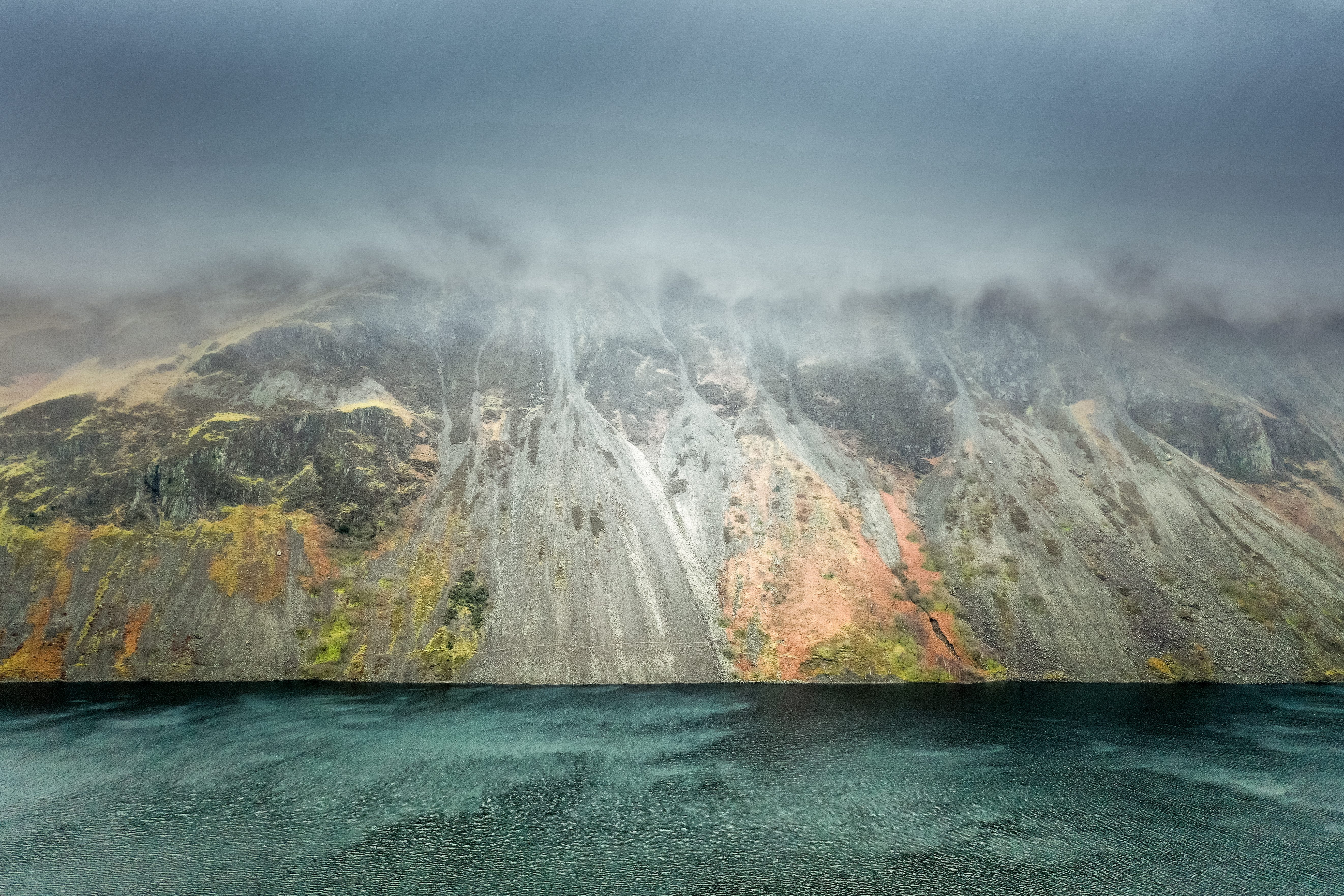
In a short break in the weather I used my Mavic 2 Pro to fly across Wast Water and capture the screes on the opposing side of the lake. This is the result........... Still showing some autumnal colours, don't you think? Wast Water or Wastwater is a lake located in Wasdale, a valley in the western part of the Lake District National Park, England. The lake is almost 3 miles long and more than one-third mile wide. It is a glacial lake, formed in a glacially 'over-deepened' valley. It is the deepest lake in England at 258 feet (79 m). The head of the Wasdale Valley is surrounded by some of the highest mountains in England, including Scafell Pike, Great Gable and Lingmell. The steep slopes on the southeastern side of the lake, leading up to the summits of Whin Rigg and Illgill Head, are known as the "Wastwater Screes" or on some maps as "The Screes". These screes formed as a result of ice and weathering erosion on the rocks of the Borrowdale Volcanic Group, that form the fells to the east of the lake, towards Eskdale.