Interested In This Footage?
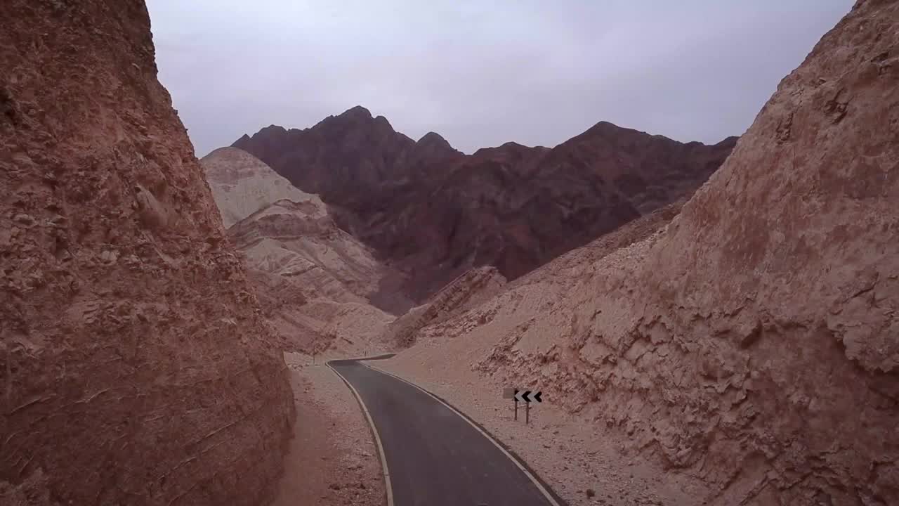
Eilat Mountains - Pure Geology
AIRVŪZ STAFF NOTE :
Check out this amazing drone video from the southern tip of Israel, courtesy of content creator and pilot lyad M. swaed. The Eilat Mountains are a chain which covers a portion of the Negev Desert. The mountains derive their name from their proximity to Eilat, the ancient port town (now also resort town) on the Red Sea. The highest peak in the mountains is Mount Hezekiah; it rises to an altitude of just under 900 meters (2.95k ft.) above sea level. Mount Solomon (also visible) is the second highest peak.
- over 7 years ago
- 1.9k VŪZ
11 


- 15
- Report
BADGES THIS VIDEO HAS EARNED:

video from Eilat Mountains, Showing pure geology, from a different point of view. Eilat Mountains is a term for a mountain range in the south of Israel, within the southern Negev. The mountains are named after the nearby city of Eilat Among the central block of mountains, Mount Hezekiah is the highest, followed by Mount Solomon (the black one in the video). music By: Ivan Dominik song: In Search Of The Perfect Tomorrow Photography equipment: DJI mavic DJI phantom 4 pro Gopro hero 6 Canon 650D + tokina 11-16 mm Galaxy S8 All footages were processed using adobe premiere software
Up Next
Dead Sea Sinkholes
- Iyad M. swaed
- 1.6k VŪZ
3 - 2
- about 5 years ago
Dead Sea shoreline
- Iyad M. swaed
- 2.2k VŪZ
39 - 38
- almost 9 years ago
Aerial views of Eilat Mountains, South Israel

- Make It Visual
- 1.3k VŪZ
13 - 22
- over 6 years ago
Israel - Eilat 2020

- baby drone
- 526 VŪZ
10 - 9
- over 5 years ago
ABOVE ISRAEL
- Moshe Tutian
- 3.5k VŪZ
26 - 17
- over 8 years ago
Utah's Mars Landscape from Above Mavic Pro 3 4K

- mikereidphotography
- 980 VŪZ
7 - 7
- about 1 year ago
Israel Cinematic Travel Film | 4K AERIAL DRONE

- koszoandras_photog...
- 2.3k VŪZ
7 - 7
- almost 3 years ago
The Fire in the Sky

- AndreaSagui
- 2.3k VŪZ
13 - 18
- over 3 years ago
Israel Rising
- B.K.SPECTOR filmma...
- 5.2k VŪZ
31 - 30
- about 9 years ago
Siccar Point | Hutton’s Unconformity | Scotland

- Play North
- 1.8k VŪZ
18 - 15
- about 7 years ago