Exploring Gaustatoppen: Norway's Breathtaking Mountain
AIRVŪZ STAFF NOTE :
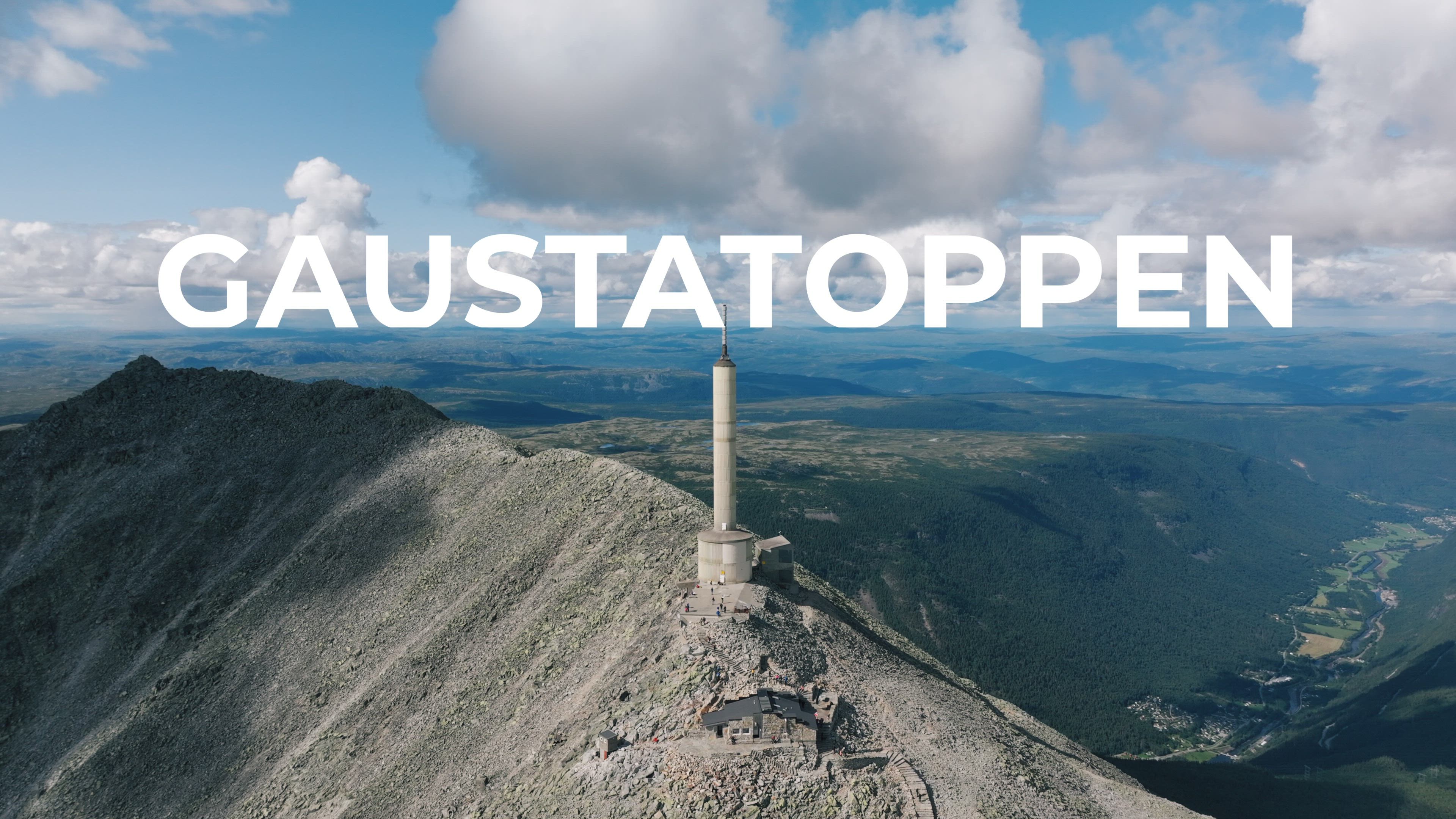
Former Drone Video Award Finalist Brent De Bleser returns to AirVuz with this outstanding drone video of famous mountain in southeastern Norway. It's called Gaustatoppen, and it's the highest peak in Vestfold og Telemark, one of the main counties of the Eastern Norway region. The mountain has a summit altitude of just under 6.2k ft. above sea level (around 1.9k m). Due to its location and high prominence, the mountaintop offers an astoundingly wide view - on a clear day, about one-sixth of the area of mainland Norway is visible!
- about 3 years ago
- 1.8k VŪZ
16 


- 15
- Report
BADGES THIS VIDEO HAS EARNED:

Gaustatoppen, located in Telemark, Norway, is a majestic mountain known for its stunning views and exciting outdoor activities. Standing at 1,883 meters above sea level, Gaustatoppen offers visitors a unique opportunity to see approximately 1/6th of Norway's mainland. To reach Gaustatoppen, you have several convenient options. If you're driving, major cities like Oslo, Kristiansand, Stavanger, and Bergen are around 2.5 to 6 hours away by car. The hike to Gaustatoppen starts at Stavsro, a location found on the road between Rjukan and Tuddal. This well-marked trail is approximately 4.3 km long and takes around 2 hours to complete one way. It is a family-friendly outing, suitable for active children who are used to longer walks. The hike rewards visitors with awe-inspiring views of Telemark's stunning landscapes. For travelers who may not wish to embark on the hike to Gaustatoppen, Gaustabanen offers a convenient and comfortable alternative. The cable car journey provides stunning panoramic views of the surrounding landscapes as it ascends to the top of the mountain. The inside of the mountain is a fascinating environment in itself, and the cable car ride adds an element of excitement and adventure to the overall experience..
Up Next
Norway's Stunning Outdoor Education

- Brent De Bleser
- 6.8k VŪZ
40 - 28
- over 9 years ago
Never Stop Exploring
- Brent De Bleser
- 1.7k VŪZ
20 - 23
- over 8 years ago
Heliboogie 2023: Base Jumping Extravaganza at Kjerag, Norway's Breathtaking Cliff

- Brent De Bleser
- 4.0k VŪZ
11 - 11
- about 3 years ago
Happy Norway!
- Brent De Bleser
- 26.8k VŪZ
103 - 59
- over 9 years ago
Lofoten: Nordic Paradise
- Brent De Bleser
- 21.4k VŪZ
90 - 59
- about 9 years ago
Sundal Folgefonna Bromance
- Brent De Bleser
- 2.5k VŪZ
36 - 34
- about 10 years ago
Lonely Boat
- Brent De Bleser
- 2.2k VŪZ
26 - 12
- over 9 years ago
Floating around Bjørndalsnuten
- Brent De Bleser
- 1.6k VŪZ
25 - 18
- almost 10 years ago
Norway: From Winter To Summer
- Brent De Bleser
- 1.7k VŪZ
26 - 18
- almost 8 years ago
Spaceship Dronie
- Brent De Bleser
- 1.6k VŪZ
24 - 23
- about 8 years ago