Gasskatjåhkkå
AIRVŪZ STAFF NOTE :
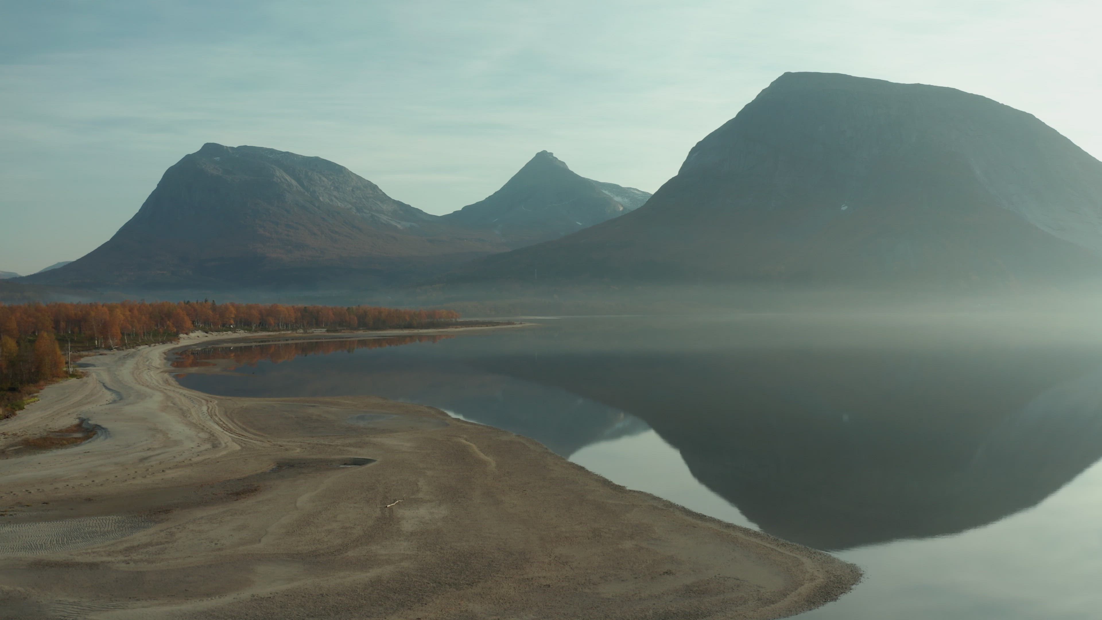
Multiple Drone Video of the Week Finalist Uglefisk brings us this fantastic drone video of a well-known mountain in Northern Norway. It's called Gasskatjåhkkå, and it's located on the border between the municipalities of Hamarøy and Sørfold in Nordland, the southernmost of the counties of the region of North Norway. The mountain has a peak elevation of just over 1.5k meters above sea level, or just under 5k ft. It's situated between the neighboring mountains of Gjerdalen and Linnajávrre.
- over 5 years ago
- 184 VŪZ
8 


- 6
- Report
BADGES THIS VIDEO HAS EARNED:

Amazing day hiking this iconic peak.
Up Next
Autoplay
Hiking around Sulitjelmaisen

- Uglefisk
- 983 VŪZ
12 - 10
- almost 6 years ago
Kjerringa & Svinetinden
- Uglefisk
- 1.5k VŪZ
11 - 13
- over 4 years ago
High and Low in the Norwegian Nature
- Uglefisk
- 1.1k VŪZ
7 - 11
- over 1 year ago
Navarsborrfjellet
- Uglefisk
- 557 VŪZ
13 - 10
- almost 6 years ago
Store Smørskredtinden
- Uglefisk
- 993 VŪZ
16 - 14
- almost 6 years ago
Four Seasons In The Mountains Of Norway
- Uglefisk
- 2.2k VŪZ
21 - 22
- over 3 years ago
Above the clouds
- Uglefisk
- 1.3k VŪZ
13 - 10
- over 4 years ago
LA PALMA: Waves, Lava & Clouds

- RiscK
- 988 VŪZ
9 - 12
- over 2 years ago
Winter in the Nederland (Februari 2021)
- Robbert roos
- 506 VŪZ
10 - 8
- over 5 years ago
- S a i l i n g -

- echoeds_fpv
- 979 VŪZ
7 - 7
- over 4 years ago