Interested In This Footage?
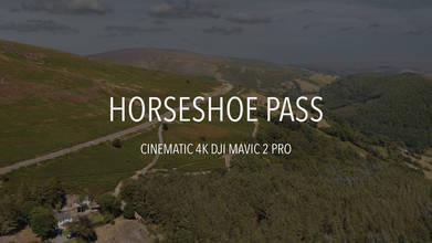
Horseshoe Pass, Wales, United Kingdom
AIRVŪZ STAFF NOTE :
Check out this beautiful drone video of a well-known mountain pass in the UK region of Wales, compliments of AirVuz contributor Dr0new Werks. It's called the Horseshoe Pass, and its located in Denbighshire, one of the counties of northeastern Wales. The pass runs between the small mountains known as Moel y Gamelin and Cyrn-y-Brain. Its name derives from the shape of the A542 road which runs though the pass. Popular with bikers and motorists, the route actually dates to the early part of the 19th century.
- almost 4 years ago
- 1.1k VŪZ
8 


- 5
- Report
BADGES THIS VIDEO HAS EARNED:

The Horseshoe Pass (Welsh: Bwlch yr Oernant, "Pass of the Cold Stream") is a mountain pass in Denbighshire, north-east Wales. It separates Llantysilio Mountain to the west from the 565 metre (1,854 feet) mountain and Marilyn Cyrn-y-Brain to the east. The A542 road from Llandegla to Llangollen runs through the pass, reaching a maximum height of 417 metres (1,368 ft). The road travels in a horseshoe shape around the sides of a valley, giving the pass its English name.
This route dates from 1811, when a turnpike road was constructed across the area. As with the rest of the roads in the Clwydian Range, it is not uncommon for sheep to gather in the road, sometimes causing problems for drivers. The road is also frequently closed in winter due to snowfall or landslides.
The Pass is well known for the Ponderosa cafe at its highest point and the scenic views along the road. Both the cafe and the pass itself are extremely popular with cyclists and motorcyclists. There are many walks and routes in the immediate area that are popular with hikers, and there are a number of campsites nearby.
Up Next
Winter at Winnats Pass in the Peak District UK

- Dr0neWerks
- 694 VŪZ
5 - 5
- about 3 years ago
Wales | Stonehenge | Castle Rising | Hunstanton Cliffs | Mavic Air

- rmt_productions
- 1.4k VŪZ
23 - 15
- about 8 years ago
Around & Above Wales - 2019
- fotosfromsky
- 1.3k VŪZ
13 - 20
- almost 7 years ago
A Weekend In Wales, United Kingdom.
- Bobventure
- 1.0k VŪZ
19 - 14
- about 8 years ago
North Wales by Drone in 4K
- Cedric Quillet
- 4.1k VŪZ
39 - 32
- about 9 years ago
Glamorgan Heritage Coast, Wales, UK

- Wilman
- 1.4k VŪZ
12 - 12
- about 8 years ago
Our 2022 Show Reel, Please Have a Watch and Enjoy the Clips from this Years Flights
- Dr0neWerks
- 677 VŪZ
4 - 3
- over 3 years ago
Beautiful North Wales Explored By Drone | Filmed Over 2.5 Years And Over 40 Locations | 2017-2020.
- Csaba Jonas
- 1.5k VŪZ
14 - 16
- about 6 years ago
Road Trip (United Kingdom) Drone Footage 2019
- Rizwan Raw
- 886 VŪZ
7 - 14
- over 6 years ago
A year in the making
- lee the flying sco...
- 1.1k VŪZ
19 - 26
- over 8 years ago