Lower Fraser
AIRVŪZ STAFF NOTE :
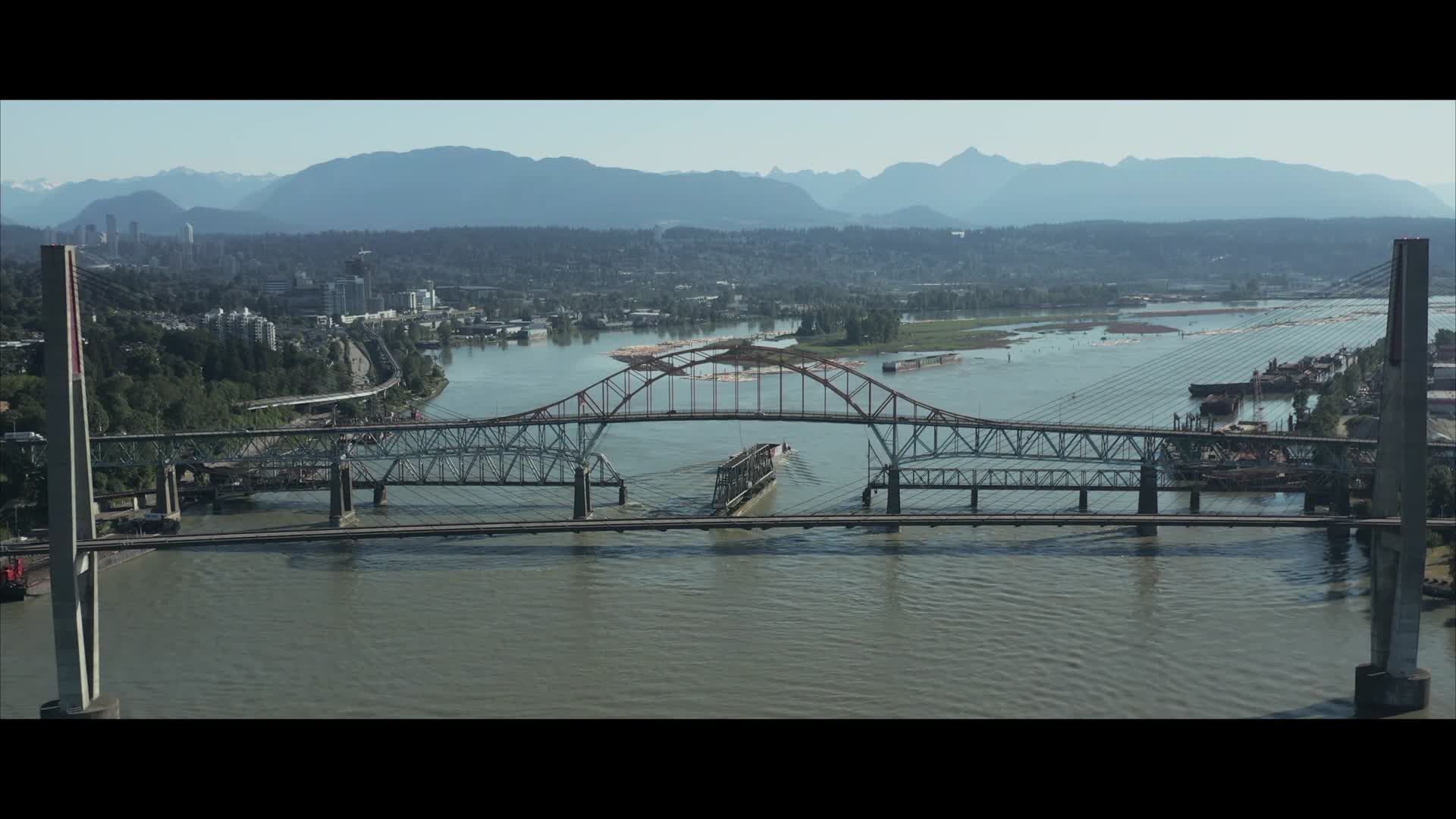
The Fraser River is the longest in the Canadian province of British Columbia. It forms in the Canadian rockies and runs nearly 1.4k km (about 850 mi.) to empty into the Strait of Georgia in Richmond, which lies just to the south of Vancouver. There are numerous bridges crossing the river, all of which are critical to the infrastructure of Greater Vancouver. In this drone video by plangereis, you'll get a nice view of the river's bridge crossings near the towns of Surrey, New Westminster, and Coquitlam.
- about 5 years ago
- 350 VŪZ
12 


- 8
- Report
BADGES THIS VIDEO HAS EARNED:

A short video of some of the bridges crossing the Fraser River between Surrey, New Westminster, and Coquitlam.
Up Next
Autoplay
Fraser Island - Queensland

- adventureswithkids
- 588 VŪZ
7 - 5
- almost 3 years ago
A short journey through BC

- Aerial Eye Visuals
- 1.2k VŪZ
29 - 19
- about 6 years ago
Riding the mountains

- Optique Video
- 1.1k VŪZ
11 - 13
- over 6 years ago
Westcoast Winter Series | Cascade Falls

- indentmedia
- 3.0k VŪZ
37 - 31
- over 7 years ago
Snow and Ice Shot of a Church in Northern Germany

- andrair.de
- 618 VŪZ
13 - 9
- over 7 years ago
Is this Ireland or Thailand?💚🇮🇪

- Ton18Drone
- 1.6k VŪZ
7 - 7
- about 1 year ago
Sailing the Great Sandy Straights (Sailing Learning By Doing EP 67)

- Vernon
- 1.3k VŪZ
11 - 4
- about 6 years ago
Yosemite National Park

- My Travels
- 640 VŪZ
7 - 9
- over 1 year ago
Sunset in Lower Barrakka Gardens, Malta

- Fpv_travel_girl
- 867 VŪZ
8 - 5
- over 1 year ago
Over the Ocean

- Scotia Droning
- 1.3k VŪZ
13 - 14
- over 7 years ago