Malin Head From Above.. Ireland's Most Northerly Point.
AIRVŪZ STAFF NOTE :
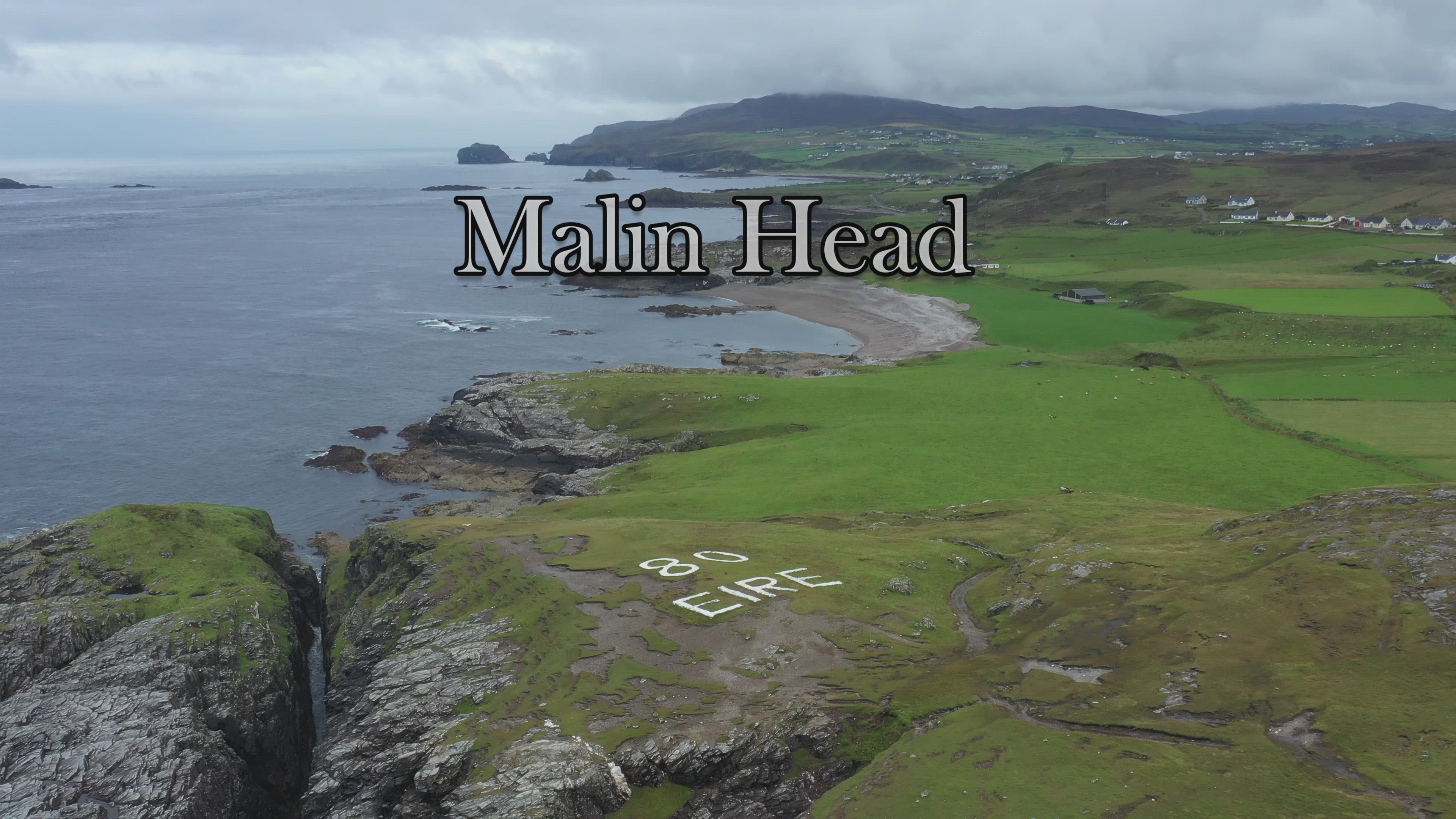
Malin Head is a promontory at the tip of Ireland's Inishowen Peninsula. Part of County Donegal in the Republic of Ireland, it represents the northernmost mainland point of the country as well as the island of Ireland (which is split between the Reublic of Ireland and the UK region of Northern Ireland). It's a beautiful stretch of coastline, albeit one which has represented a grave danger to shipping over the ages. In this drone video by AIrVuz contributor Mark's Mavic 2, you'll get an aerial view of the Malin Head area.
- over 5 years ago
- 472 VŪZ
14 


- 8
- Report

BADGES THIS VIDEO HAS EARNED:

Filmed with my Mavic 2 Pro on a very dull day. Hoped for better weather, but it was not to be. Malin Head on the Inishowen Peninsula, County Donegal, is usually given as the most northerly headland of the mainland of Ireland. In fact, the most northerly point is a headland named Banba’s Crown on the Inishowen Peninsula about 2 km to the northeast. Banba was one of the mythical queens of Ireland. There is a weather station on the head. On the northernmost tip stands a stark cliff-top tower that was built in 1805 by the British admiralty and later used as a Lloyds signal station. Around it are concrete huts that were used by the Irish army in WWII as lookout posts. To the west from the fort-side car park, a path leads to Hell’s Hole, a chasm where the incoming waters crash against the rocky formations. To the east a longer headland walk leads to the Wee House of Malin, a hermit’s cave in the cliff face. Hope you enjoy the video.
Up Next
Old Head Lighthouse, Cork, Ireland. Mavic 2 Pro

- Mark's Mavic 2
- 1.3k VŪZ
22 - 18
- about 7 years ago
Fly Over Donegal, Ireland. Glenveagh National Park, Doe Castle, Mount Errigal, Dunlewey Church. 4K.
- Mark's Mavic 2
- 794 VŪZ
14 - 11
- over 5 years ago
Lough Tay, The Guinness Lake. Ireland. Mavic 2 pro
- Mark's Mavic 2
- 1.8k VŪZ
31 - 21
- almost 8 years ago
Carlingford Lough, Ireland. Warrenpoint, Northern Ireland
- Mark's Mavic 2
- 654 VŪZ
6 - 5
- over 5 years ago
Loop Head. Wild Atlantic Way, Ireland
- Mark's Mavic 2
- 780 VŪZ
7 - 9
- 2 months ago
Powerscourt Waterfall from Above
- Mark's Mavic 2
- 1.1k VŪZ
11 - 7
- over 5 years ago
Welcome to Ireland

- Peter and Loki
- 1.6k VŪZ
16 - 19
- almost 6 years ago
Slane Castle. County Meath Ireland.
- Mark's Mavic 2
- 692 VŪZ
10 - 7
- almost 7 years ago
First flight with Mavic 2 Pro. Bray, Ireland
- Mark's Mavic 2
- 633 VŪZ
13 - 10
- almost 8 years ago
Dun laoghaire, Ireland, Mavic 2 Pro 4k
- Mark's Mavic 2
- 508 VŪZ
11 - 8
- almost 8 years ago