Mountains of México
AIRVŪZ STAFF NOTE :
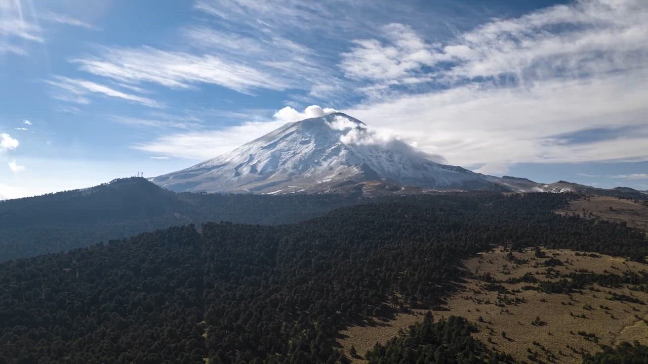
For a first upload to AirVuz, new contributor GaboAR brings us this outstanding drone video from the Trans-Mexican Volcanic Belt, a line of volcanic mountains which runs through the heart of Mexico. The mountains featured, in order of first appearance, are as follows: Iztaccihuatl, which lies toward the eastern end of the belt; Pico de Orizaba (Citlaltépetl), Mexico's highest mountain, which stands 18.5k ft. above sea level (5.6k m); Peña de Bernal, a monolith in the state of Querétaro; and Popocatépetl, Mexico's second-highest peak.
- almost 3 years ago
- 2.0k VŪZ
14 


- 19
- Report

BADGES THIS VIDEO HAS EARNED:

Footage of the mountains in Central Mexico, captured by a drone in time-lapse and hyper-lapse. The scenery was breathtaking, with towering peaks and rolling clouds drifting through the valleys and some sunrises. The drone's ability to capture the changing lights and moving clouds was extraordinary, painting a beautifully vivid portrait of the most remarkable mountains and monoliths of the center of the country.
The locations were:
- Popocatépetl volcano, placed between the states of Puebla and México City.
- Iztaccíhuatl volcano, is right next to Popocatépetl.
- Citlaltépetl volcano, located in the states of Puebla and Veracruz.
- Peña de Bernal, a monolith located in the town of Bernal in the state of Querétaro.
Up Next
Arid Mountains

- Luis Stevens
- 876 VŪZ
14 - 13
- over 8 years ago
El Chepe

- jelipegomez
- 948 VŪZ
13 - 13
- almost 8 years ago
This is: Lienzo en el Aire

- lienzoenelaire
- 2.7k VŪZ
33 - 16
- over 9 years ago
This is Monterrey, the city of mountains.

- thedronexperience
- 1.9k VŪZ
11 - 18
- almost 6 years ago
¡Viva México!

- Postandfly
- 2.4k VŪZ
22 - 22
- almost 5 years ago
Meztitla Mountains and Forest

- Mino FPV
- 632 VŪZ
9 - 4
- almost 4 years ago
JACARANDAS [the Mexico City Blossom]

- inigui
- 2.2k VŪZ
13 - 15
- over 7 years ago
Pollution in Mexico City
- Postandfly
- 2.6k VŪZ
21 - 16
- about 7 years ago
México desde arriba
- Conexión Destinos
- 4.3k VŪZ
32 - 31
- over 9 years ago
FLIGHT IN ZACATECAS

- Fotografía aérea
- 1.7k VŪZ
13 - 12
- about 6 years ago