South Pacific Islands
- about 6 years ago
- 318 VŪZ
11 


- 8
- Report
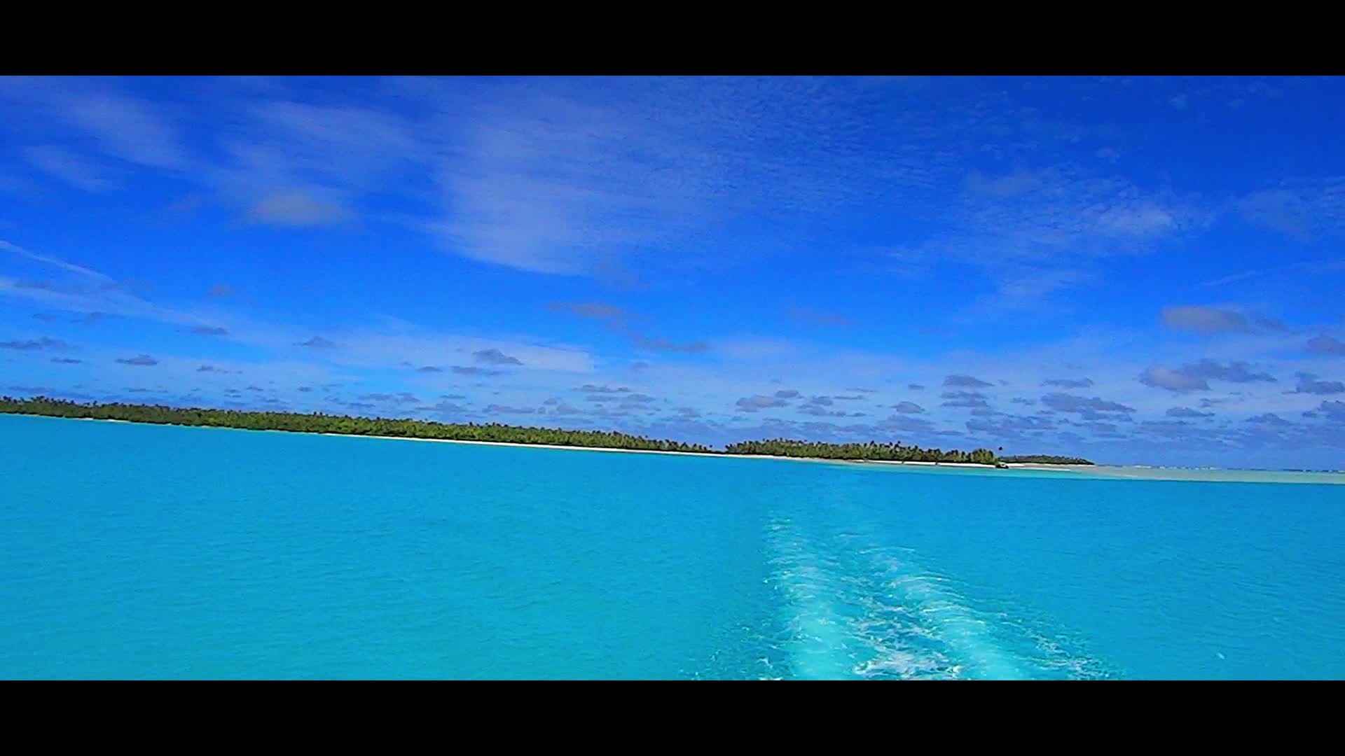
Aitutaki (Cook Islands): Aitutaki, also traditionally known as Araʻura and Utataki, is one of the Cook Islands, north of Rarotonga. It has a population of approximately 2,000. The main village is Arutanga on the west side. Tikehau: Tikehau (meaning Peaceful Landing in Tuamotuan or Porutu-kai is a coral atoll in the Palliser Islands group, part of the Tuamotu Archipelago in French Polynesia. It is included in the commune of Rangiroa. Tikehau is located 340 kilometres (210 miles) northeast of Tahiti in the Tuamotu Islands. The nearest atoll, Rangiroa, lies only 12 kilometres (7.5 miles) to the east. Mataiva, the westernmost atoll of the same group, is located 35 kilometres (22 miles) to the west. The atoll's oval-shaped lagoon is 27 kilometres (17 miles) long and 19 kilometres (12 miles) wide with a lagoon area of about 461 square kilometres (178 square miles). The atoll is made up of two major islands and numerous islets. The northeastern quarter of the atoll is a single, mostly uninhabited island. The whole atoll is surrounded by an almost continuous coral reef. There is a single pass deep and wide enough for navigation in and out of the lagoon. Tuheiava Pass is located on the western shore. The main village is called Tuherahera. Fakarava: Fakarava, Havaiki-te-araro, Havai'i or Farea is an atoll in the west of the Tuamotu group in French Polynesia. It is the second largest of the Tuamotu atolls. The nearest land is Toau Atoll, which lies 14 kilometres (8.7 miles) to the northwest. The shape of Fakarava Atoll is roughly rectangular and its length is 60 kilometres (37 miles) and its width 21 kilometres (13 miles). Fakarava has a wide and deep lagoon with a surface of 1,112 square kilometres (429 square miles) and two passes. The main pass to enter the lagoon, located in its north-western end, is known as Passe Garuae and it is the largest pass in French Polynesia; the southern pass is called Tumakohua (also known as Tetamanu. It has a land area of 24.1 square kilometres (9 square miles). Fakarava has 837 inhabitants; the main village is called Rotoava. Bora Bora: Bora Bora is a 30.55 km2 (12 sq mi) island group in the Leeward group in the western part of the Society Islands of French Polynesia, an overseas collectivity of the French Republic in the Pacific Ocean. The main island, located about 230 kilometres (143 miles) northwest of Papeete, is surrounded by a lagoon and a barrier reef. In the center of the island are the remnants of an extinct volcano rising to two peaks, Mount Pahia and Mount Otemanu, the highest point at 727 metres (2,385 feet). It is part of the commune of Bora-Bora, which also includes the atoll of Tūpai. The major settlement, Vaitape, is on the western side of the main island, opposite the main channel into the lagoon. Produce of the island is mostly limited to what can be obtained from the sea and the plentiful coconut trees, which were historically of economic importance for copra. Travel with passion!
Up Next
French Polynesia - Atoll AHE
- Marmot
- 1.8k VŪZ
18 - 25
- over 6 years ago
French Polynesia - Atoll TIKEHAU Lazy afternoon (4)
- Marmot
- 1.6k VŪZ
17 - 22
- about 6 years ago
French Polynesia - Atoll TIKEHAU (2)
- Marmot
- 1.1k VŪZ
14 - 19
- over 6 years ago
French Polynesia - Atoll TIKEHAU (3)
- Marmot
- 1.2k VŪZ
13 - 16
- over 6 years ago
Set of different French Polynesian islands (chill out)
- Marmot
- 1.1k VŪZ
13 - 11
- over 6 years ago
Lake Emma (New Zealand)
- Marmot
- 1.2k VŪZ
23 - 27
- about 6 years ago
Rotokakahi, Waikaremoana and Tikitapu lakes (New Zealand)
- Marmot
- 1.5k VŪZ
22 - 32
- about 6 years ago
New Zealand - Lake Pukaki and Otago region (Wanaka)
- Marmot
- 1.0k VŪZ
13 - 18
- over 6 years ago
Lake Tekapo and its surroundings (New Zealand)
- Marmot
- 1.1k VŪZ
16 - 20
- about 6 years ago
Epic Bora Bora, Taha'a, Moorea and Tahiti in MOMENTS in PARADISE - French Polynesia (4K)

- Jus Medic
- 1.5k VŪZ
17 - 18
- almost 5 years ago