ZONA SUR EN LAS ALTURAS - UN VUELO EN DRONE
AIRVŪZ STAFF NOTE :
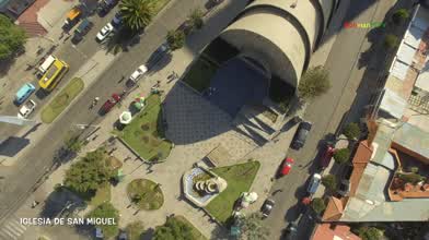
La Paz is the capital of Bolivia and the center of its largest metropolitan area. Among other distinctions, it's known as the highest capital city in the world, with an elevation of 3.6k km above sea level (about 12k ft). It's in a plateau-valley which is surrounded by some of the taller peaks in this part of the Andes Mountains system. This drone video will give you a bird's eye view of La Paz, which was founded (like almost all South American capital cities) by Spanish conquistadoras in the 16th century.
- over 9 years ago
- 3.3k VŪZ
21 


- 13
- Report

BADGES THIS VIDEO HAS EARNED:

LA ZONA SUR DE LA CIUDAD DE LA PAZ VISTA DESDE LOS CIELOS. SOUTH DISTRICT FROM LA PAZ BOLIVIA )SOUTH AMERICA) SEEN FROM THE SKY.
Up Next
Autoplay
In Search of a Sunrise - Cinematic FPV

- YoseGonFPV
- 1.5k VŪZ
7 - 9
- about 3 years ago
The Big Rock - FPV Tenerife
- YoseGonFPV
- 1.8k VŪZ
3 - 3
- almost 3 years ago
Oyambre, El Arenal

- pepeferreras
- 875 VŪZ
7 - 6
- over 1 year ago
Buenos Aires costanera sur, Las Nereidas

- rodrigo rio
- 869 VŪZ
12 - 5
- about 5 years ago
Dolomites

- Paco Ferrando
- 847 VŪZ
8 - 6
- over 3 years ago

My REWIND 2022 - CINEMATIC FPV REEL
- YoseGonFPV
- 1.7k VŪZ
5 - 4
- over 3 years ago
A lake on top of the mountain
- Danik Mennov
- 574 VŪZ
8 - 4
- over 7 years ago
Parque Arqueológico San Andrés

- fotovideorestudiosv
- 639 VŪZ
10 - 4
- almost 8 years ago
Torre de la Malladeta-Drone 4K

- gasendi
- 982 VŪZ
0 - 0
- about 3 years ago