Myrdalsjokull Ice Cap and Glaciers Mavic 3 Pro
AIRVŪZ STAFF NOTE :
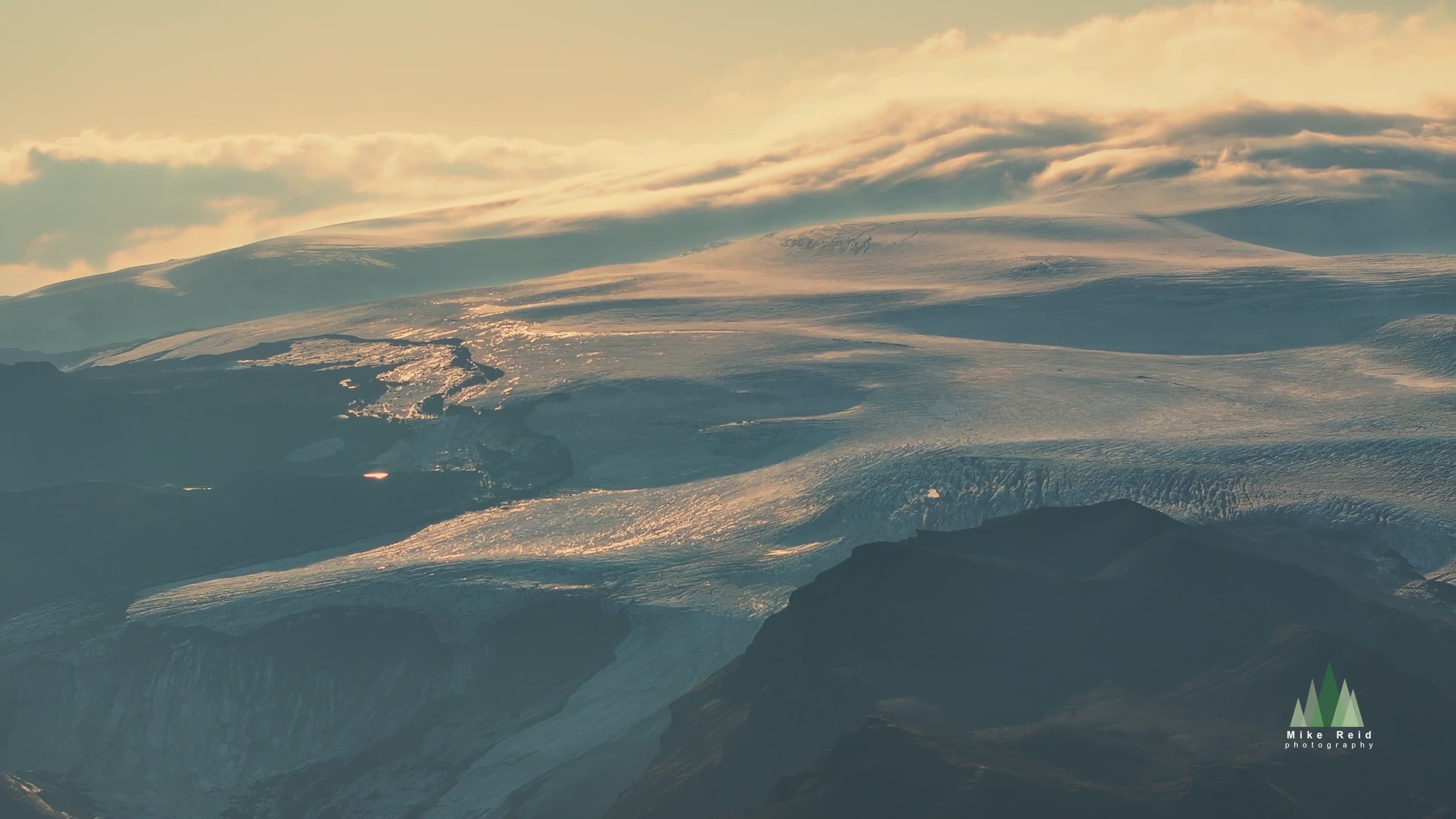
In this drone video by AirVuz contributor mikereidphotography, you'll explore the Mýrdalsjökull ice cap in southern Iceland. Mýrdalsjökull covers about 230 square mi. (around 600 square km) just north of the town of Vik and a few miles/km off the national Route 1 (aka the Ring Road). It's considered part of the Highlands (the mountains which cover much of interior Iceland) and includes the active (but not recently) volcano Katla. The highest point of the icecap is just under 5k ft. above sea level (around 1.5k m).
- 8 months ago
- 1.2k VŪZ
11 


- 11
- Report
BADGES THIS VIDEO HAS EARNED:

Myrdalsjokull is a massive ice cap in Southern Iceland which dominates the horizon. I maxed out the Mavic 3 Pro to have a look around sunset. dLogM
Up Next
Autoplay
Jokulsarlon Icebergs Sunset Mavic 3 Pro

- mikereidphotography
- 1.0k VŪZ
10 - 10
- 8 months ago
North Cascades Early Winters Spires Mavic Pro 3
- mikereidphotography
- 967 VŪZ
10 - 8
- 11 months ago
North Cascades Silver Star Sunrise Mavic Pro 3
- mikereidphotography
- 1.5k VŪZ
9 - 10
- 11 months ago
Iceland: Sunset Glow in the Highlands
- mikereidphotography
- 961 VŪZ
4 - 4
- 9 months ago
Vatnajökull Glacier, Iceland

- FreD ./.
- 2.0k VŪZ
13 - 19
- over 2 years ago
Mount Baker Evening Snowscape Mavic 3 Pro
- mikereidphotography
- 1.3k VŪZ
9 - 10
- 11 months ago
Mount Rainier Over Chinook Pass DJI Mavic 3 Pro
- mikereidphotography
- 1.6k VŪZ
7 - 5
- 11 months ago
Mount Baker in the Sun Autel Evo 2 4K
- mikereidphotography
- 1.1k VŪZ
1 - 2
- almost 2 years ago
Iceland
- Peter van Haastrecht
- 936 VŪZ
18 - 26
- over 4 years ago
Iceland Canyon Colors Mavic 3 Pro
- mikereidphotography
- 1.1k VŪZ
9 - 11
- 8 months ago