Noordwaard polder is flooded under water in The Netherlands | Water mangement
AIRVŪZ STAFF NOTE :
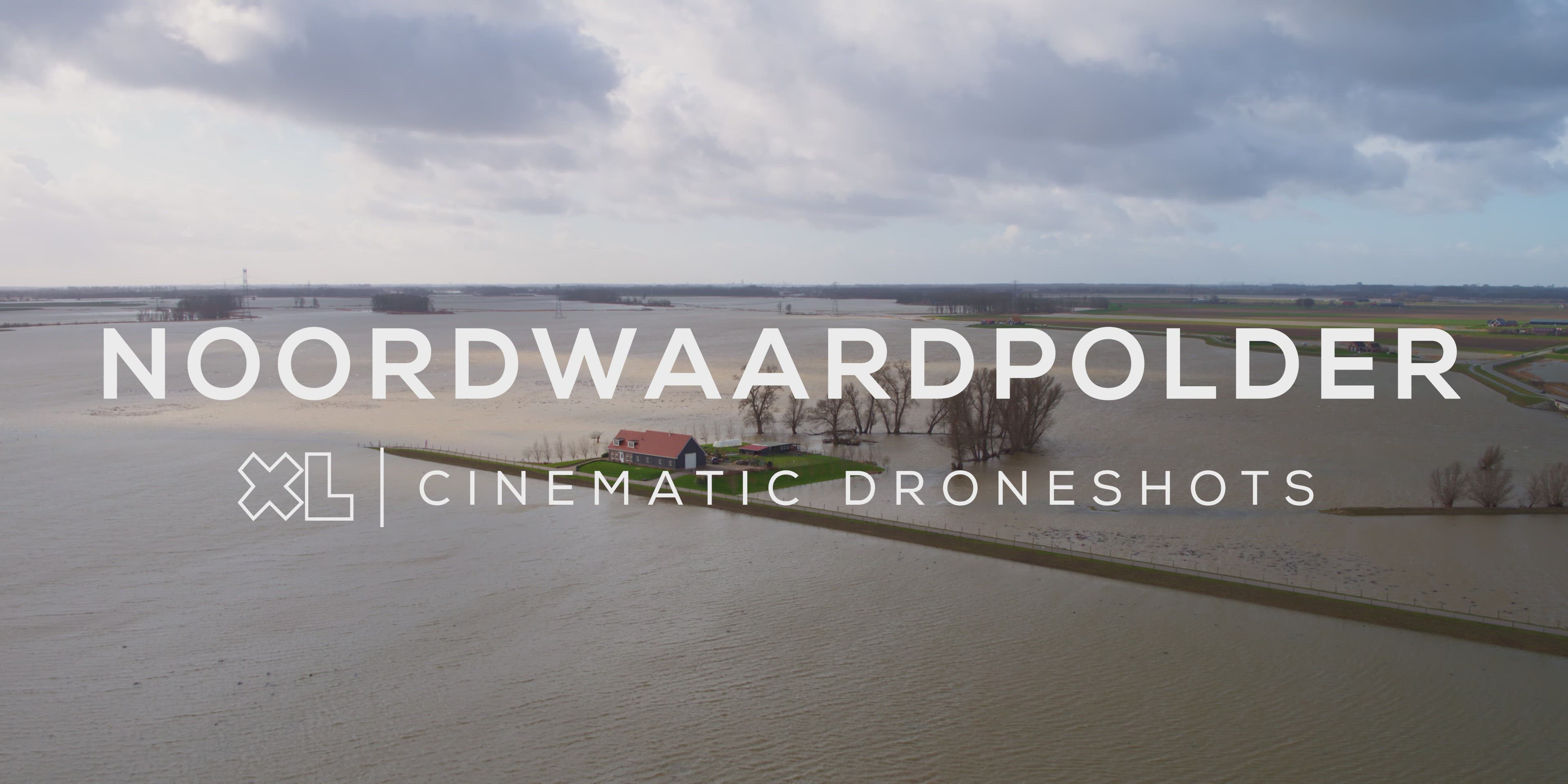
With some of the earth's lowest-lying coastal areas, the Netherlands is profoundly affected by climate change. In this drone video by top contributor XL Creations, you'll get an aerial view of what this looks like in practice. The video was filmed over the Noordwaard Polder, an area of the province of Nord Brabant which had been protected from the sea by a typical Dutch dyke system. Since 2015, parts of the area have been allowed to flood when water levels reach certain critical levels, thus sparing its more populated areas.
- about 5 years ago
- 661 VŪZ
10 


- 9
- Report


BADGES THIS VIDEO HAS EARNED:

The Noordwaardpolder in the Biesbosch near Werkendam is full of water from the Boven-Merwede. The polder, which collects the water from the river to lower the level at Gorinchem, is completely submerged. The Noordwaard has been a so-called through-flow area since 2015. The dikes are 2 meters above sea level. When the water rises, it automatically flows into the polder. It is arranged in such a way that the roads and houses remain dry. It is some clever watermanagement in the Netherlands to make sure the water doesn't rise too much in rivers and cause floods in unwanted areas (like cities).
Up Next
Drowned Land of Saeftinghe, Netherlands

- XL Creations
- 1.4k VŪZ
15 - 9
- about 8 years ago
Loosdrechtse Plassen, Scheendijk, Netherlands
- XL Creations
- 1.9k VŪZ
29 - 21
- about 8 years ago
Wadden Island Texel, The Netherlands
- XL Creations
- 712 VŪZ
11 - 10
- over 4 years ago
Maasvlakte, Rotterdam, Netherlands (Industry) in 4K
- XL Creations
- 2.7k VŪZ
24 - 14
- over 8 years ago
Klundert (Noord-Brabant) in 4K | Drone video
- XL Creations
- 1.9k VŪZ
31 - 15
- almost 8 years ago
Zeelandbrug (Zierikzee) in 4K
- XL Creations
- 3.6k VŪZ
37 - 20
- over 8 years ago
Naarden. The most beautiful fortified city in the Netherlands
- XL Creations
- 1.1k VŪZ
15 - 7
- almost 7 years ago
Lighthouse Westhoofd (Ouddorp, The Netherlands)
- XL Creations
- 2.2k VŪZ
24 - 13
- about 7 years ago
Windmill between the meadows

- droneflybennie
- 918 VŪZ
9 - 12
- almost 5 years ago
SCHELPHOEK Aerial DJI Mavic Pro

- EarthPropeller
- 1.3k VŪZ
12 - 16
- almost 8 years ago