Interested In This Footage?
Pakistan by Drone - Makran Coastal Highway
AIRVŪZ STAFF NOTE :
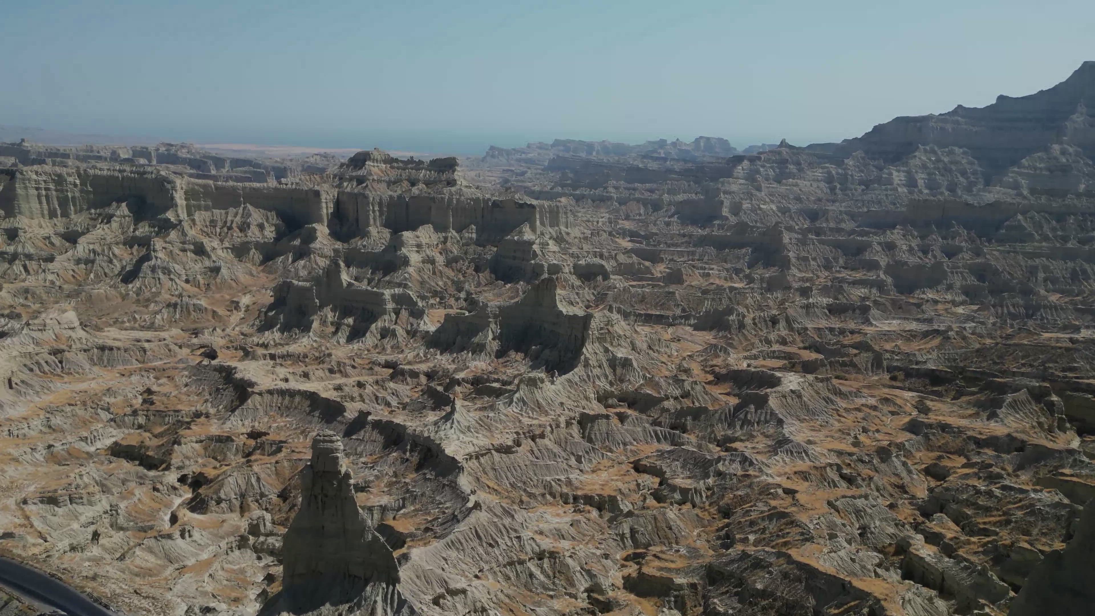
Check out these drone views of Pakistan's Makran Coastal Highway, compliments of AirVuz contributor and pilot nayyar2006. Also known as National Highway 10, the road stretches for about 400 mi. (around 650 km) along the country's Arabian Sea coastline in the giant province of Balochistan, from Gawadar in Pakistan's southwestern corner to the great port city of Karachi in the east. Completed in the early 2000's, the highway provided the first paved road connection to Gawadar, an emerging regional transportation and distribution hub.
- about 2 years ago
- 1.3k VŪZ
13 


- 10
- Report
BADGES THIS VIDEO HAS EARNED:

This video features the Makran Coastal Highway (National Highway 10) in Balochistan. The highway passes through a varied landscape of desert, mountains, badlands, coast, and even mud volcanoes from eastern Balochistan to the Iranian border.
Up Next
Kund Malir: Mesmerizing Beach Sunrise
- Shayhaq Baloch
- 1.1k VŪZ
11 - 10
- about 6 years ago
Gilgit Baltistan by Drone Part 2

- nayyar2006
- 982 VŪZ
1 - 1
- 4 months ago
Pakistan by Drone - Forts to Forests
- nayyar2006
- 1.6k VŪZ
8 - 7
- about 2 years ago
Pakistan by Drone - Central Punjab
- nayyar2006
- 1.6k VŪZ
2 - 2
- about 2 years ago
Gilgit Baltistan by Drone Part 1
- nayyar2006
- 1.0k VŪZ
0 - 0
- 5 months ago
Pakistan by Drone - The Salt Range, Punjab Part 2
- nayyar2006
- 915 VŪZ
4 - 3
- 12 months ago
This is Pakistan
- nayyar2006
- 1.5k VŪZ
8 - 4
- 5 months ago
Pakistan by Drone - Cholistan Desert
- nayyar2006
- 1.7k VŪZ
13 - 11
- about 2 years ago
Khyber Pakhtunkhwa by Drone - Lulusar National Park and Naran Valley
- nayyar2006
- 1.1k VŪZ
6 - 5
- 5 months ago
Pakistan by Drone - Sindh
- nayyar2006
- 958 VŪZ
7 - 7
- about 2 years ago