Interested In This Footage?
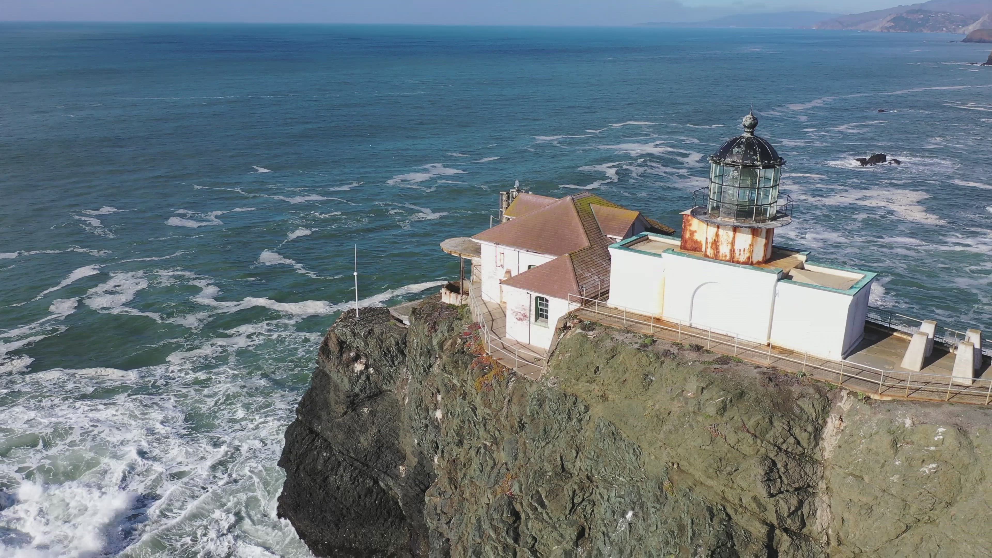
Point Bonita Lighthouse
AIRVŪZ STAFF NOTE :
Point Bonita is a narrow peninsula situated at the northern entrance to the Golden Gate, the strait which connects the Pacific Ocean and San Francisco Bay and which is spanned by its namesake bridge. The point's namesake lighthouse has long played an important role as a navigation aid to ship traffic in and out of the bay. Seen here in this drone video by splineglass, Point Bonita Lighthouse was first lit in 1877, replacing an earlier version built in the 1850's. Automated since 1980, it was California's last manned lighthouse.
- over 4 years ago
- 282 VŪZ
18 


- 9
- Report
BADGES THIS VIDEO HAS EARNED:

Dating back to 1855, this is the third lighthouse on the west coast of the United States. It is reachable only by a suspension bridge. Of course, coast-side views of it are only possible from a boat or a drone.
Up Next
Autoplay
PACIFIC COAST - 2017 (MUIR OVERLOOK, POINT BONITA LIGHTHOUSE, & BEACHES)

- mamitagadventures
- 1.4k VŪZ
26 - 20
- over 7 years ago
Pacific Coast at Montara

- splineglass
- 1.3k VŪZ
3 - 1
- over 2 years ago
Pigeon Point Lighthouse
- markfromlondon
- 552 VŪZ
7 - 8
- about 9 years ago
Point Sur Lighthouse (Short Version)

- jayxlamar
- 745 VŪZ
12 - 9
- over 6 years ago
Aloft in California - Point Sur Lighthouse 4K

- AdventurousDrone
- 1.0k VŪZ
12 - 10
- about 5 years ago
Eastern Point Lighthouse - Gloucester MA 4K Drone Experience!

- PO3SMITH
- 806 VŪZ
9 - 7
- about 4 years ago
Point Arena Lighthouse - California, USA in 4K

- Earth Mappers
- 536 VŪZ
8 - 3
- over 6 years ago
Great Point, Nantucket
- PO3SMITH
- 951 VŪZ
27 - 10
- over 8 years ago
Neist Point, Skye

- Albion Drones
- 860 VŪZ
5 - 7
- 9 months ago
Flight over Alcatraz

- splineglass
- 1.1k VŪZ
17 - 12
- over 4 years ago