Interested In This Footage?
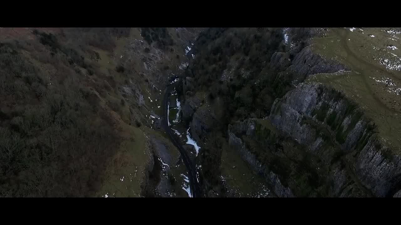
Cheddar Gorge Fly over with DJI Phantom 3 Advanced - Somerset - UK
- over 7 years ago
- 68 VŪZ
6 


- 1
- Report
Fly over cheddar gorge in Somerset united kingdom, with the phantom 3 advanced Cheddar Gorge is a limestone gorge in the Mendip Hills, near the village of Cheddar, Somerset, England. The gorge is the site of the Cheddar show caves, where Britain's oldest complete human skeleton, Cheddar Man, estimated to be over 9,000 years old, was found in 1903. Older remains from the Upper Late Palaeolithic era (12,000–13,000 years ago) have been found. The caves, produced by the activity of an underground river, contain stalactites and stalagmites. The gorge is part of a Site of Special Scientific Interest called Cheddar Complex. Cheddar is a gorge lying on the southern edge of the Mendip Hills. The maximum depth of the gorge is 137 m (449 ft), with a near-vertical cliff-face to the south, and steep grassy slopes to the north. The B3135 road runs along the bottom of the gorge. The area is underlain by Black Rock slate, Burrington Oolite and Clifton Down Limestone of the Carboniferous Limestone Series, which contain ooliths and fossil debris, on top of Old Red Sandstone and by Dolomitic Conglomerate of the Keuper. Evidence for Variscan orogeny is seen in the sheared rock and cleaved shales. In many places weathering of these strata has resulted in the formation of immature calcareous soils. The gorge was formed by meltwater floods during the cold periglacial periods which have occurred over the last 1.2 million years. During the ice ages permafrost blocked the caves with ice and frozen mud and made the limestone impermeable. When this melted during the summers, water was forced to flow on the surface, and carved out the gorge. During warmer periods the water flowed underground through the permeable limestone, creating the caves and leaving the gorge dry, so that today much of the gorge has no river until the underground Cheddar Yeo river emerges in the lower part from Gough's Cave. The river is used by Bristol Water, who maintain a series of dams and ponds which supply the nearby Cheddar Reservoir, via a 137-centimetre (54 in) diameter pipe that takes water just upstream of the Rotary Club Sensory Garden, a public park in the gorge opposite Jacob's Ladder. The gorge is susceptible to flooding. In the Chew Stoke flood of 1968 the flow of water washed large boulders down the gorge, damaging the cafe and entrance to Gough's Cave and washing away cars. In the cave itself the flooding lasted for three days. In 2012 the B3135, the road through the gorge, was closed for several weeks following damage to the road surface during extensive flooding
Up Next
Bird's Eye View Over Cheddar Gorge, Somerset, UK

- John_W13
- 1.7k VŪZ
4 - 7
- over 2 years ago
Cheddar Gorge

- BenLumber
- 1.0k VŪZ
12 - 10
- over 6 years ago
Britains Biggest Gorge... Cheddar Gorge!!! (Drone Footage)

- MrJakeSilvester
- 1.0k VŪZ
14 - 10
- about 6 years ago
Somerset, UK: Chedder Gorge, Glastonbury Tor, and Weston-super-Mare

- Nathan Jermy
- 1.1k VŪZ
13 - 12
- almost 7 years ago
Somerset Aerial: Glastonbury Tor, Cheddar Gorge, and Stonehenge
- ForAdun
- 1.8k VŪZ
17 - 16
- over 7 years ago
Aerial Adventure // Cheddar Gorge Sunset // 4K

- Joshua Paul Gardner
- 4.0k VŪZ
29 - 30
- over 8 years ago
Winter at Winnats Pass in the Peak District UK
- Dr0neWerks
- 661 VŪZ
5 - 5
- over 2 years ago
Bristol by Drone
- maskedinsanity
- 1.4k VŪZ
12 - 7
- over 6 years ago
Weston-super-Mare and Cheddar Gorge

- seb-depp
- 979 VŪZ
0 - 0
- 11 months ago
Our 2022 Show Reel, Please Have a Watch and Enjoy the Clips from this Years Flights
- Dr0neWerks
- 665 VŪZ
4 - 3
- almost 3 years ago