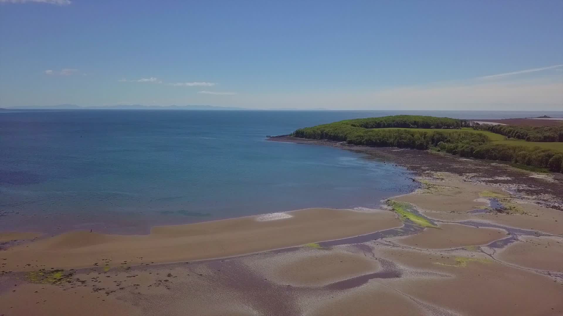
Rigg Bay. Galloway
AIRVŪZ STAFF NOTE :
Contributor Albacross Imaging created this fascinating drone video of a historical site in southwestern Scotland. The spot is called Rigg Bay, and it's on the western side of the Solway Firth, which serves as the border between the Scotland and England regions of the United Kingdom. The site was used to develop the famous Mulberries which were used to support the Allied D-Day landings in World War II. These were artificial harbors built in the days immediately following the Normandy landings on June 6, 1944.
- almost 7 years ago
- 1.6k VŪZ
15 


- 13
- Report
BADGES THIS VIDEO HAS EARNED:

In 1943 the bay was used to secretly test and develop landing equipment which would be used during the Normandy D day deployment, as the bay had similar characteristics to the French beaches.The project was called Mullberry Harbour.
Up Next
Autoplay
Sunrise at the Mull of Galloway Lighthouse

- jimthorley
- 985 VŪZ
7 - 7
- about 1 year ago
Scotland in Motion | Crawick Multiverse

- L.A. Media
- 3.1k VŪZ
18 - 11
- over 8 years ago
Blair Castle

- Albacross Imaging
- 1.2k VŪZ
17 - 18
- over 8 years ago
Tantallon Castle & The Bass Rock
- Albacross Imaging
- 2.5k VŪZ
31 - 26
- about 9 years ago
Buachaille Etive Mòr
- Albacross Imaging
- 2.5k VŪZ
22 - 16
- over 8 years ago
Urquhart Castle by Loch Ness
- Albacross Imaging
- 937 VŪZ
12 - 9
- almost 9 years ago
Saint Monans
- Albacross Imaging
- 1.1k VŪZ
22 - 15
- over 8 years ago
Gosford House
- Albacross Imaging
- 760 VŪZ
11 - 7
- over 7 years ago
Glenfinnan
- Albacross Imaging
- 2.8k VŪZ
27 - 20
- over 8 years ago
Callanish Standing Stones & Luskentyre Beach Isle of Lewis & Harris
- Albacross Imaging
- 1.6k VŪZ
16 - 18
- about 8 years ago