Stelvio Pass | Stilfser Joch | Passo dello Stelvio | Drone 4K 60 FPS
AIRVŪZ STAFF NOTE :
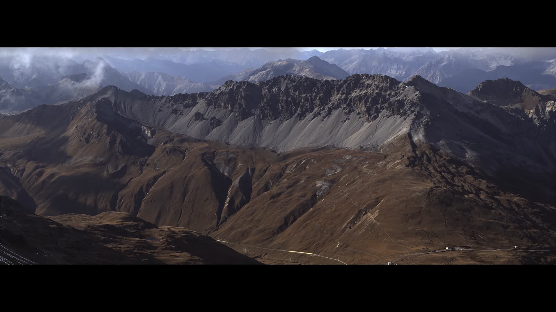
See the famous Stelvio Pass by drone in this 4K video by Dronescapes by Atellani. The Stelvio Pass connects the town of Stilfs in the South Tyrol Province and Bormeo in the province of Sondrio. With an elevation of 2.75k meters above sea level (just over 9k ft.), it's the second highest paved pass in the Alps. The original road was built between 1820 - 1825, when the area was part of the Austrian Empire. Between the Italian War of 1859 and World War I, the pass served as the boundary between the Austro-Hungarian Empire and Italy.
- over 6 years ago
- 528 VŪZ
10 


- 9
- Report

BADGES THIS VIDEO HAS EARNED:

TOP Gear defines Italy's Stelvio Pass:: "One of the World's greatest roads". The Stelvio Pass (Italian: Passo dello Stelvio) is a mountain pass in northern Italy, at an elevation of 2,757 m (9,045 ft) above sea level. It is the highest paved mountain pass in the Eastern Alps, and the second highest in the Alps. The original road was built in 1820–25 by the Austrian Empire to connect the former Austrian province of Lombardy with the rest of Austria, covering a climb of 1,871 m (6,138 ft) The engineer and project manager was Carlo Donegani (1775–1845). Since then, the route has changed very little. Its seventy-five hairpin turns, 48 of them on the northern side numbered with stones, are a challenge to motorists. Stirling Moss went off the road here during a vintage car event in the 1990s, with an onboard video of his incident being shown on satellite TV. Before the end of World War I, it formed the border between the Austro-Hungarian Empire and the Italian Kingdom. The Swiss had an outpost and a hotel (which was destroyed) on the Dreisprachenspitze (literally, Three-Language-Peak). During World War I, fierce battles were fought in the ice and snow of the area, with gun fire even crossing the Swiss area at times. The three nations made an agreement not to fire over Swiss territory, which jutted out in between Austria (to the north) and Italy (to the south). Instead they could fire down the pass, as Swiss territory was up and around the peak. After 1919, with the expansion of Italy, the pass lost its strategic importance.
Up Next
Passo dello Stelvio - Stelvio Pass - Stilfser Joch (Italy)

- Kpax
- 1.2k VŪZ
15 - 16
- almost 7 years ago
Passo dello Stelvio | The Stelvio Pass by drone | 4K UHD Stilfser Joch

- Dronescapes by Ate...
- 1.9k VŪZ
18 - 23
- over 7 years ago
Italy's Stelvio Pass: 5K Epic Drone Video

- Dronescapes by Ate...
- 2.3k VŪZ
29 - 20
- about 8 years ago
Off the beaten path
- Dronescapes by Ate...
- 1.9k VŪZ
24 - 25
- almost 8 years ago
Stelvio Pass - Autumn Edition 🍁(Trentino - Alto Adige, Italy)
- Kpax
- 523 VŪZ
4 - 4
- over 4 years ago
Stelvio - An Alpine Roadtrip Trailer
- mk-foto.eu
- 1.1k VŪZ
12 - 6
- over 9 years ago
Alps

- ChristianDX
- 2.0k VŪZ
6 - 10
- over 3 years ago
Valtellina Drone Tour pt.1

- DADRONE
- 2.1k VŪZ
19 - 16
- about 9 years ago
Autumn's Flight. The Timmelsjoch & Jaufenpass by drone. 6K UHD Aerial
- Dronescapes by Ate...
- 1.0k VŪZ
18 - 23
- over 7 years ago
Ortles glacier
- Andrea Giumelli
- 623 VŪZ
4 - 2
- almost 3 years ago