Pawnee National Grassland
AIRVŪZ STAFF NOTE :
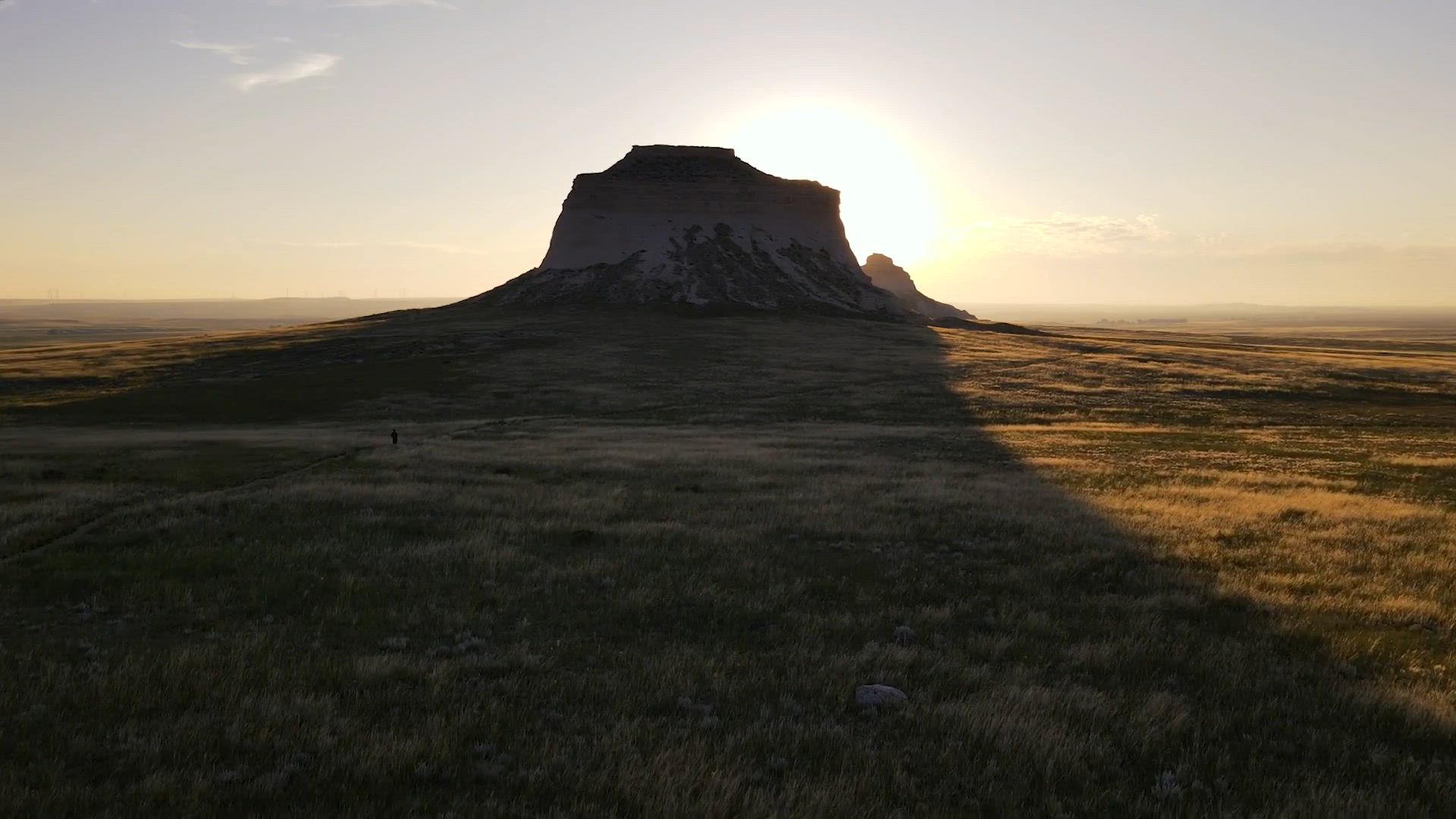
While the USA state of Colorado is closely associated with the Rocky Mountains, the eastern third of the state has a much different topography - that of the Great Plains, which give way to the mountains roughly on the north-south line running through Denver and Colorado Springs. In this drone video by AIrVuz contributor Where-is-Fab, you'll get a bird's eye view of the Eastern Colorado Plains in Pawnee National Grasslands, which covers about 300 square mi. (a bit under 1k square km) in Weld County, in the northeastern part of the state.
- almost 3 years ago
- 1.9k VŪZ
15 


- 12
- Report

BADGES THIS VIDEO HAS EARNED:

I am finally moving to Colorado. It has always been on my mind but it just took 12 years and life twists to finally getting a push in that direction. After driving 1300 mi from Detroit going through the states of Illinois, Iowa and Nebraska, I wanted to find a place to rest before starting the new chapter. I noticed Pawnee National Grassland on the map just 2h north of Denver and decided to give it a shot. Mostly flat with cattle and oil extracting sites except 2 infamous Buttes that are popping out of the ground. Some sparse primitive campsites are available for free close the the trailhead to the buttes.
Up Next
Tongariro Alpine Crossing - Drone Diaries .02

- Where-is-Fab
- 1.5k VŪZ
18 - 12
- about 8 years ago
Drone Diaries 01: Hiking Chiang Dao, Thailand
- Where-is-Fab
- 1.6k VŪZ
14 - 10
- about 8 years ago
A short flight over Dominica
- Where-is-Fab
- 1.1k VŪZ
19 - 11
- over 6 years ago
Torres de Paine, Chile: Hiking the W Circuit
- Where-is-Fab
- 3.7k VŪZ
42 - 24
- about 8 years ago
Canaima National Park- Venezuela

- Djivzla Drone
- 3.7k VŪZ
41 - 21
- almost 10 years ago
Tony
- Where-is-Fab
- 1.8k VŪZ
8 - 7
- over 3 years ago
Shorty @ Campo Imperatore
- Luca_B3n
- 622 VŪZ
12 - 10
- over 6 years ago
Keota Colorado

- Mikeyg733
- 595 VŪZ
8 - 8
- over 9 years ago
Carrizo Plain Superbloom 2019 4K (highlights)

- alanzfpv
- 937 VŪZ
12 - 18
- about 6 years ago
El Calafate (Argentina) & Torres del Paine (Chile)

- hectorespinosa
- 1.6k VŪZ
22 - 29
- about 7 years ago